
Havre Volcano
The bucket that started my interest.
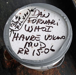
31deg 1.9’South, 178deg 58.8’West, 1830 m depth
|
Learn about this expedition to study the largest recorded explosive volcanic eruption in history, a cruise named "Mapping Exploration and Sampling at Havre" (MESH).
Email from Geologist Dan Fornari
Hi Joan –
I’m out with ROV Jason and Sentry AUV here 2 days north of New Zealand at Havre Volcano, a submarine volcano that erupted in 2012. We have been doing some gravity coring and there was some extra mud that I’ve stashed away for you. The Jason system will be back at WHOI in late June and I’ll bring it over to you.
If you want info on where we are and about Havre Volcano you can find it at this website.
Hope all is well with you.
The position of the mud sample is:
31deg 1.9’S
178deg 58.8’W
1830 m depth
Best
Dan