
Collected Mud Stories
Sometimes hard work is also fun, especially when it brings people together in curiosity. These are a few of those stories.
Mud from Phoenician Wreck
I didn’t know Sarah Webster, then an engineer at WHOI, until she called to say she had some mud, was leaving town, and did I want it? I did. She left it at my door and emailed me about it. It came from inside amphorae that carried either wine or olive oil. The ships sank about 750 BC.
A few years later, by happy serendipity, I met Dan Isenberg, who was then teaching international entrepreneurship, beginning with a lecture on Phoenician trade. He pointed me to photomosaics created by Hanumant Singh. All of us in Woods Hole!
Snowball Earth
When WHOI scientist Bernhard Peucker-Ehrenbrink brought me this powder made from a ground-up Namibian rock, I didn’t know anything about “Snowball Earth.” The Namibian rocks are mostly from 020°11.970’South, 015°00.987’East, where Bernhard is cutting from the cliff.
Earth covered with ice or maybe slush at the equator 650 million years ago? On porcelain clay the rock power melted into white rivulets.
Galapagos
Dan Fornari, a WHOI geologist appreciates symbiosis between science and art. Photo shows him hauling up a dredge in the Galapagos, where I got sediments shown in teir raw forms and then, on the urn, fired into light and dark colored glazes. Dark sample from 1°52.96′ N, 91°16.96′ W, 1,600 m depth and light sample from 0°47.21′ N.
Speckled brown area close to the rim is the K-T Band sediment. Sediment closer to the center is from the Mid-Atlantic Ridge.
Cretaceous Tertiary Boundary
Sediment from the first core to show a clear chemical signature of this boundary: a tiny spike of iridium at the depth of about 65 to 66 million years ago. Jim Broda described it as the “Dinosaur-killing cloud of extra-terrestrial dust from the K-T Band.”
The sediment is from 30.44°19.9’ north, 157°49.0’ west, 3100 to 3115 meters deep. It’s from ship Long Lines, cruise 44, October 1976, Leg #1.
I have this material because I made a memorial gift in honor of Charles David Hollister and gave it to the Woods Hole Oceanographic Institution
Mid-Atlantic Ridge
Slurry from the Kane Fracture Zone
Core drilled from the Mid-Atlantic Ridge was brought to land and cut with water for lubrication. The cut produced a fine rock powder in slurry, which I melt into glaze. This might be my favorite — Earth’s crust.
Thanks to Eben Franks, I know the slurry is from the Mid-Atlantic Ridge, Research Vessel Knorr cruise 180 (November–December 2004), at 23.5° North, 45° West. Drilled from 2,000 to 3,600 meters depth; age 1.5 to 2.5 million years. He described the buckets he brought me as “glop from rock saws, high in manganese,” with peridotite, serpentine, basalt, and olivine gabbro.
Eben said, “It has spent significant time in Hell, meaning that it is from rocks that were buried deeply within the ocean crust, under immense pressure and high temperature – the very crucible of ocean crust formation. . . . The mantle is exposed at this location, which is called the Kane Megamullion.”
Two sides of a rock sample given to me by Jessica Warren, who polished one side.
Left: this one slurry can be sheer over porcelain or dense and rock-like. Right: a thick pour of slurry contracted as the water evaporated, then self-sorted into brick-like shapes in the kiln.
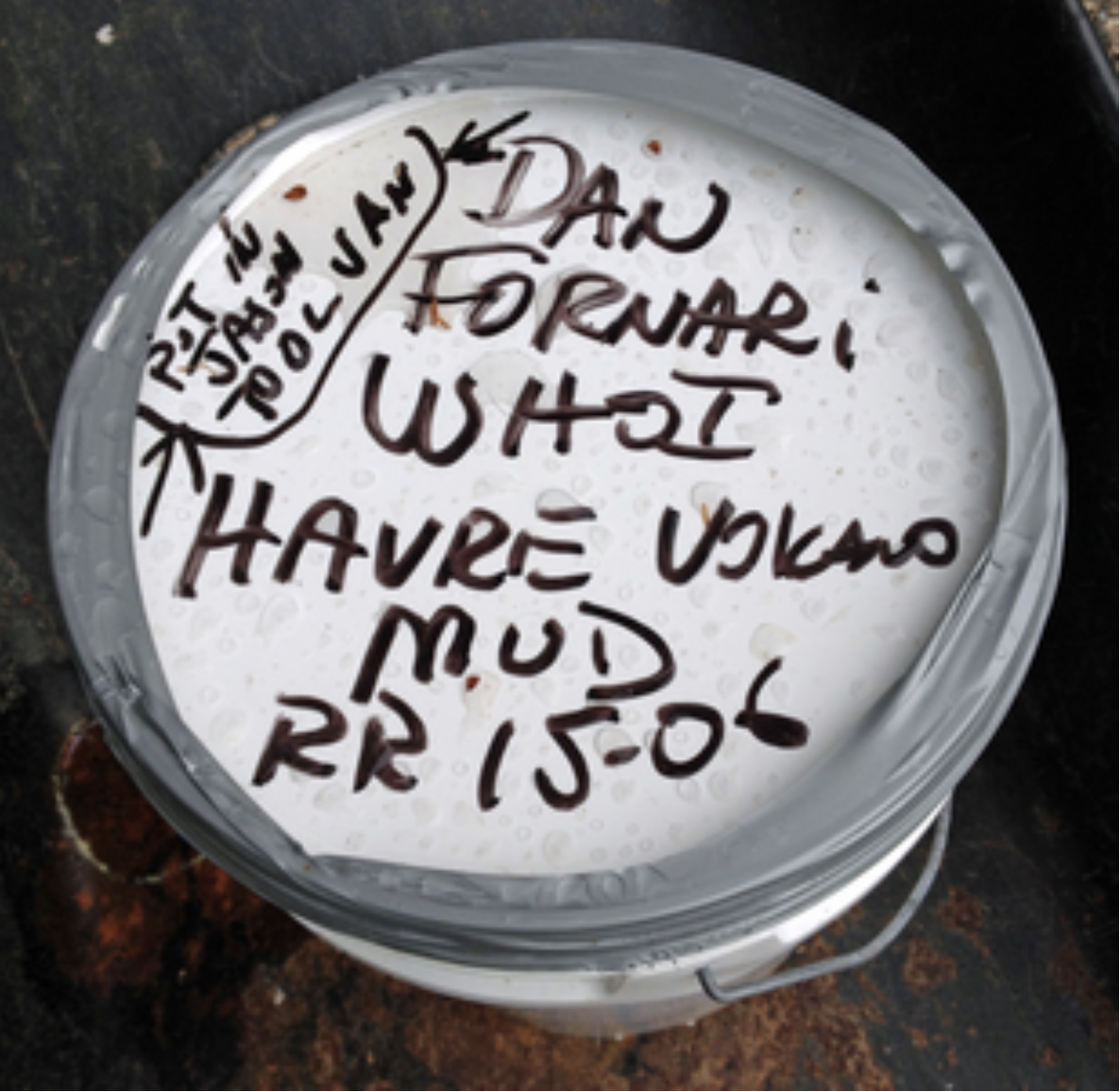
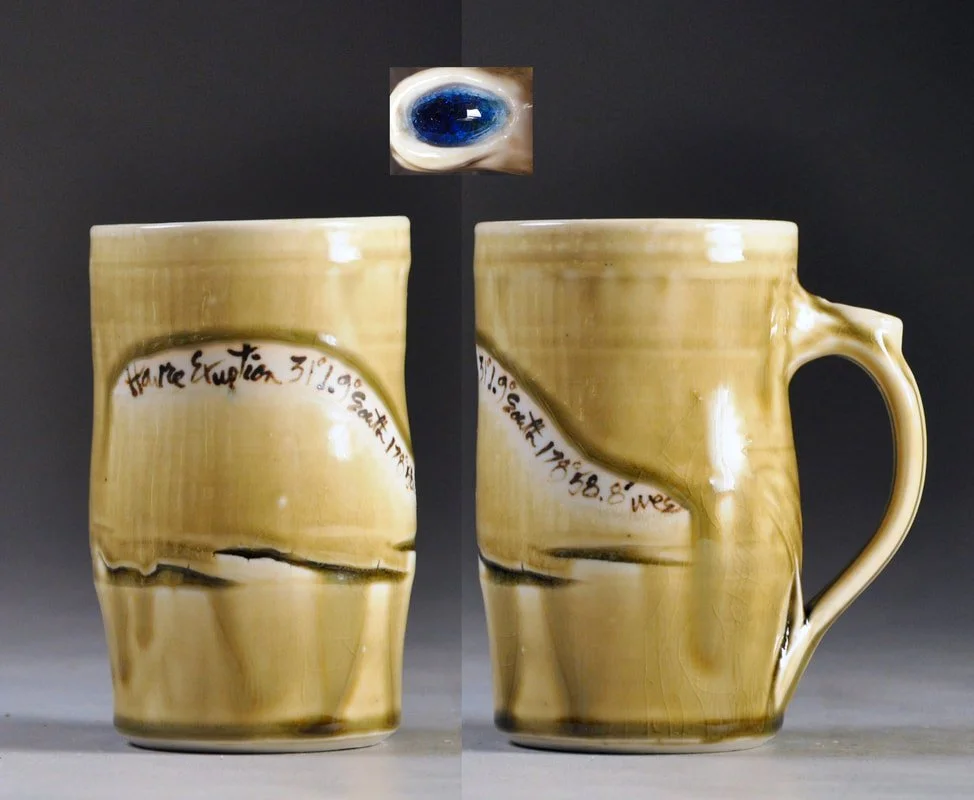
RR 15-06 refers to R/V Roger Revelle, cruise 1506. Mug glazed with that sediment.
Dan Fornari of Woods Hole knew this pumice-laden sediment would be rich in silica. It was the first sample to teach me that magma is the common source of both dense basalt pillow lavas and lightweight pumice.
The mug was a eureka moment. The porcelain folded beneath my fingers, and I worked with the undulations, which are like the undulations of the seafloor in microcosm. I dipped the translucent porcelain in the Havre sediment and kept it as my own.
Havre Eruption
Hi Joan –
I’m out with ROV Jason and Sentry AUV here 2 days north of New Zealand at Havre Volcano, a submarine volcano that erupted in 2012. We have been doing some gravity coring and there was some extra mud that I’ve stashed away for you. The Jason system will be back at WHOI in late June and I’ll bring it over to you.
If you want info on where we are and about Havre Volcano you can find it at this website.
Hope all is well with you.
The position of the mud sample is:
31deg 1.9’S, 178deg 58.8’W, 1830 m depth
Best
Dan
Fukushima Study
I heard, “Hey Joan!" as I crossed the street after a trip to the post office. Chris Griner gave me sediment from a cruise of R/V Tansei Maru that monitored radiation in sediment off Japan. He assured me that the mud wasn't “hot”, and grabbed a bag to scribble on, showing me the location off Japan.
Later I met Ken Buesseler, a radiation chemist whose lab responded to the radioactivity released by the Fukushima nuclear plant. Ken gave me another sample and brought a Geiger counter to my studio to show the muds were safe. He also commissioned gifts to bring to colleagues in Japan.